Ireland's Tailte Éireann Secures €1.69 Million GIS Managed Services Contract with Esri Ireland Through 2030
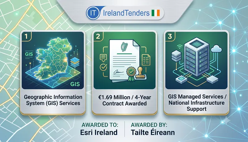
Tailte Éireann, Ireland's national mapping and property registration authority, has awarded a four-year contract worth €1.69 million for Geographic Information System (GIS) managed services to Esri Ireland. The deal, signed on 6 July 2026, covers infrastructure management, enterprise management, incident response, proactive monitoring and platform management for the authority's GIS applications environment, reflecting the growing importance of geospatial data in Irish public administration.
Introduction
Every modern government depends on accurate geospatial data. Land registration, property valuation, mapping, and countless other public services rely on Geographic Information Systems to function effectively. When those systems need to be secure, reliable and scalable, the infrastructure management becomes critical. At Tailte Éireann, that responsibility now rests with Esri Ireland, after Ireland's national mapping agency signed off on a new GIS managed services contract worth up to €1.69 million over four years.
It is not a flashy technology deal. But it is the kind of contract that keeps Ireland's land and property information infrastructure running smoothly, and it says a great deal about how Irish public bodies are approaching the management of critical geospatial systems.
Why This Contract Matters
Tailte Éireann, formed in 2023 from the merger of the Property Registration Authority, the Valuation Office and Ordnance Survey Ireland, is the State's authoritative source for land and property information. Its GIS applications underpin everything from property transactions and land registration to emergency response planning and environmental management.
This contract represents the managed services backbone of those applications. The authority needs incident management, proactive monitoring and platform management to ensure security, reliability and scalability. Without this support, the GIS environment could experience downtime or performance issues that would affect thousands of users and critical public services.
Contract Timeline
- Previous notice referenced: ef529ea0-9fe6-4b8b-91d4-73751d1b87ed-02
- Contract award notice published: 15 July 2026 (OJ S 134/2026)
- Contract concluded: 6 July 2026
- Duration: 48 months (4 years)
Contract Overview
Tailte Éireann ran an open procedure under EU Directive 2014/24/EU, receiving two tenders. The result is a direct contract (not a framework agreement) covering GIS managed services.
The contract covers:
- Infrastructure Management through a service level agreement for hosted infrastructure and web applications
- Enterprise Management to enable continued running of the applications environment
- Incident Management to respond to and resolve issues
- Proactive Monitoring to identify and address potential problems before they affect users
- Platform Management to maximise the security, reliability and scalability of the GIS applications environment
The contract is structured as a single lot with a four-year term.
Key Contract Details
| Detail | Information |
| Contracting authority | Tailte Éireann |
| Winning bidder | Esri Ireland |
| Contract subject | GIS Managed Services, CPV 72000000 |
| Procedure type | Open procedure |
| Legal basis | EU Directive 2014/24/EU |
| Estimated value (excl. VAT) | €2,500,000 |
| Value of contract awarded | €1,694,035 |
| Contract duration | 48 months (4 years) |
| Bids received | 2 |
| EU funding | None disclosed |
| Covered by GPA | Yes |
| Contract signed | 6 July 2026 |
Project Scope
The contract covers GIS Managed Services for Tailte Éireann's applications environment. The scope includes:
- Infrastructure Management - Provisioned through a service level agreement for hosted infrastructure and web applications
- Enterprise Management - Enabling the continued running of the applications environment
- Incident Management - Responding to and resolving incidents
- Proactive Monitoring - Identifying potential issues before they affect users
- Platform Management - Maximising security, reliability and scalability of the GIS applications environment
The services are to be delivered in Dublin, where Tailte Éireann is headquartered.
About the Contracting Authority
Tailte Éireann is Ireland's national mapping and property registration authority. It was established in 2023 through the merger of the Property Registration Authority, the Valuation Office and Ordnance Survey Ireland. The authority is responsible for:
- Land registration and property ownership records
- Property valuation for local and national taxation
- National mapping and geospatial data
- The national coordinate reference system and place names
As the authoritative source for land and property information in Ireland, Tailte Éireann's GIS applications are critical infrastructure for the Irish State.
About the Winning Company
Esri Ireland is the Irish subsidiary of Esri, the global leader in Geographic Information System software. Esri's ArcGIS platform is the industry standard for geospatial analysis and mapping. Esri Ireland is classified as a medium-sized enterprise and is headquartered in Clonee, County Dublin.
The company provides GIS software, services and support to public and private sector clients across Ireland, including government departments, local authorities and utilities. This contract is a significant win for Esri Ireland, representing a strategic engagement with Ireland's national mapping authority.
Procurement Analysis
Procedure: An open procedure was used, meaning any interested supplier could submit a tender. This is the standard route for service contracts where requirements are well-defined.
Competition: Two tenders were received. This is a relatively low level of competition, reflecting the specialist nature of the services required and the limited number of firms with the necessary GIS infrastructure management expertise in Ireland.
Evaluation criteria: Quality carried the dominant weight (80%) compared to cost (20%). The specific quality sub-criteria are detailed in the Request for Tender (RFT) but are not published in the notice. The weighting of quality over cost reflects the critical nature of the services: Tailte Éireann prioritises service quality, reliability and technical competence over price alone.
Framework structure: No framework agreement was used. This is a direct contract with a single supplier for the four-year term.
GPA status: The contract falls under the WTO's Government Procurement Agreement, meaning it was open to qualifying international bidders, though the winning bidder is Irish.
Green Procurement: The notice references "Other Green Public Procurement criteria" and "Pollution prevention and control" as strategic objectives, indicating that environmental considerations were integrated into the procurement.
Additional Procurement Facts
- The contract references a previous notice (ef529ea0-9fe6-4b8b-91d4-73751d1b87ed-02), indicating a phased procurement process.
- The procedure was not accelerated, indicating a standard timeline was followed.
- No framework agreement was used; this is a direct supply contract.
- No dynamic purchasing system was used.
- Disputes or review requests fall to The High Court of Ireland.
Market & Industry Perspective
Geographic Information Systems are increasingly critical to public administration. From land registration and property valuation to emergency response, environmental monitoring and urban planning, GIS underpins a wide range of government services. As data volumes grow and user expectations increase, public authorities are turning to managed services to ensure the reliability and security of their GIS environments.
This contract reflects a broader trend in Irish public procurement: using managed services contracts to secure ongoing support for critical systems, rather than relying on in-house teams or ad-hoc project-based engagement. The four-year term gives Tailte Éireann stability and predictability, while Esri Ireland gains a strategic reference in the Irish public sector.
Economic Significance
At €1.69 million over four years, this contract represents a significant investment in the ongoing operation of Tailte Éireann's GIS environment. The estimated value of €2.5 million was not fully utilised, suggesting that the authority achieved good value for money through the competitive process.
For Esri Ireland, the contract offers predictable revenue and a strong reference in the Irish public sector. For Tailte Éireann, the contract provides service assurance and technical expertise that would be difficult and expensive to maintain in-house.
Future Procurement Opportunities
The four-year term means this contract will not be re-tendered until 2030. The notice does not indicate whether the contract includes options for renewal. Suppliers not successful in this procurement may look for opportunities in other Irish public bodies that use GIS managed services, including local authorities and other government departments.
Opportunities for Suppliers
For GIS and IT service providers, the key takeaway is that Irish public authorities are increasingly seeking managed services for critical systems, with quality weighted more heavily than cost. Firms should focus on demonstrating technical excellence, service reliability and understanding of the authority's mission.
The inclusion of green procurement criteria also suggests that suppliers with strong environmental credentials, such as energy-efficient hosting or sustainable IT practices, may have a competitive advantage in future tenders.
What Businesses Should Watch
- Whether other Irish public bodies adopt similar managed services approaches for GIS and other critical systems.
- The specific quality sub-criteria in the RFT, which may signal future procurement priorities.
- Green procurement criteria in Irish public tenders, which may become more prominent in future contracts.
IrelandTenders Procurement Intelligence
This contract is a useful case study in how Irish public authorities manage critical geospatial systems. By using a managed services contract with a single provider, Tailte Éireann gains access to specialist expertise, guaranteed service levels and predictable costs, while avoiding the overhead of maintaining an in-house team for all aspects of GIS infrastructure management.
The 80/20 weighting of quality over cost is notable. For critical infrastructure, Irish public authorities clearly prioritise service reliability and technical competence over price. This may reflect lessons learned from past incidents where low-cost providers failed to deliver adequate service.
The inclusion of green procurement criteria, even in a technology services contract, signals that environmental considerations are becoming a standard part of Irish public procurement, even for services that are not obviously "green." This trend is likely to continue and expand.
Supplier Takeaways
- Quality is weighted more heavily than cost; firms should focus on demonstrating technical excellence and service reliability.
- Green procurement criteria are increasingly relevant even for IT services; suppliers should prepare for environmental requirements.
- Managed services contracts offer multi-year revenue predictability for winning suppliers.
- Specialist providers with a strong track record in GIS are well-positioned in this market.
- The four-year term provides stability and a strong reference for winning suppliers.
Key Takeaways
- Tailte Éireann awarded a €1.69 million GIS managed services contract to Esri Ireland.
- The contract runs for 48 months (4 years), signed on 6 July 2026.
- Two bids were received through an open procedure weighted toward quality (80%) over cost (20%).
- The contract covers infrastructure management, enterprise management, incident management, proactive monitoring and platform management.
- The contract is covered by the GPA and includes green procurement criteria.
- Services are to be delivered in Dublin.
Conclusion
This is not a high-profile contract, but it reflects something structurally important about how Irish public administration manages its geospatial infrastructure. By securing managed services through a quality-weighted procurement, Tailte Éireann has ensured that its GIS environment—critical to land registration, property valuation and national mapping—will be secure, reliable and scalable through to 2030. Esri Ireland now carries that responsibility for Ireland's national mapping authority.
Frequently Asked Questions
Q: What is Tailte Éireann?
Tailte Éireann is Ireland's national mapping and property registration authority, formed in 2023 from the merger of the Property Registration Authority, the Valuation Office and Ordnance Survey Ireland.
Q: What is a Geographic Information System (GIS)?
A GIS is a system for capturing, storing, analysing and managing spatial or geographic data. It is used for mapping, land registration, environmental monitoring and many other applications.
Q: What are managed services?
Managed services are the outsourcing of routine IT operations and infrastructure management to a specialist provider under a service level agreement.
Q: Why was quality weighted more heavily than cost?
For critical infrastructure, service reliability and technical competence are more important than cost; poor performance can disrupt essential public services.
Q: What is the GPA?
The Government Procurement Agreement is a WTO agreement that opens public procurement markets to international bidders from signatory countries.
Q: Is this contract covered by EU funding?
No. The notice confirms the procurement is not financed with EU funds.
Source: EU Official Journal, Notice publication number: 488431-2026, OJ S 134/2026, published 15 July 2026.

Fresh and verified Tenders from Ireland. Find, search and filter Tenders/Call for bids/RFIs/RFPs/RFQs/Auctions published by the government, public sector undertakings (PSUs) and private entities.
- 1,000+ Tenders
- Verified Tenders Only
- New Tenders Every Day
- Tenders Result Data
- Archive & Historical Tenders Access
- Consultants for RFI/RFP/RFQ
- Tender Notifications & Alerts
- Search, Sort, and Filter Tenders
- Bidding Assistance & Consulting
- Customer Support
- Publish your Tenders
- Export data to Excel
- API for Tender Data
- Tender Documents

Fill out the form below and you will receive a call from us within 24 hours.
Get FREE SAMPLE TENDERS from Ireland in your email inbox.
Copyright © 2014-2026 IrelandTenders.com. All Rights Reserved.