Tailte Éireann Secures €2 Million Framework for Geographic Information System Professional Services
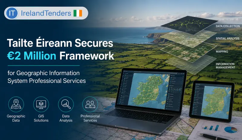
A single-supplier framework agreement for Geographic Information System (GIS) professional services worth up to €2 million has been awarded by Tailte Éireann. The contract, won by Esri Ireland, demonstrates how Ireland's national mapping and property agency is leveraging specialist GIS expertise to enhance its GeoHive, MapGenie, and web GIS services.
Introduction
Every citizen, business, and government agency in Ireland relies on accurate geographic information to make informed decisions. From property boundaries and land registration to mapping and spatial analysis, geographic information systems (GIS) are essential for modern public administration. Tailte Éireann, Ireland's national mapping and property agency, has taken a significant step to enhance its GIS capabilities by awarding a new single-supplier framework agreement for GIS professional services.
While not a headline-grabbing consumer deal, this contract is fundamental to ensuring that Tailte Éireann can deliver high-quality geographic information services to the Irish public. It reveals a great deal about how Irish public sector organisations procure specialist GIS expertise to support their digital transformation.
Why This Contract Matters
Tailte Éireann is the Irish state agency responsible for property registration, land mapping, and geographic information services. The agency manages critical national datasets, including the land registry, mapping data, and the GeoHive portal, which provides access to geographic information for citizens, businesses, and government agencies.
This framework agreement covers GIS specialist resource augmentation and professional services, including GIS development, maintenance, and support. The services support the ongoing delivery of Tailte Éireann's GeoHive, MapGenie, and web GIS work priorities, enabling the agency to respond to business objectives in a timely and efficient manner.
Contract Timeline
- Previous notice referenced: 7d22b1c6-8dca-4bc9-a5c8-160bb644ed01-01
- Contract award notice published: 3 August 2026 (OJ S 147/2026)
- Contract concluded: 13 July 2026
- Coverage duration: 4 Years
Contract Overview
Tailte Éireann conducted an open procedure for a single-supplier framework agreement for Geographic Information System (GIS) professional services. The framework covers:
- GIS Specialist Resource Augmentation: Additional GIS specialists to support and enable the ongoing delivery of GeoHive, MapGenie, and web GIS work priorities.
- Professional Services: GIS development, maintenance, and support to enable Tailte Éireann to bring in additional GIS resources as required to respond to business objectives in a timely and efficient manner.
The estimated value of the framework is €2,000,000. The contract duration is 4 years. The framework is a single-supplier framework without reopening of competition. The procurement received five tenders, with Esri Ireland selected as the winner. The award criteria were heavily weighted toward quality (80%) and cost (20%).
Key Contract Details
| Detail | Information |
|---|---|
| Contracting Authority | Tailte Éireann |
| Winning Bidder | Esri Ireland |
| Contract Subject | IT services: consulting, software development, Internet and support (CPV 72000000) |
| Procedure Type | Open procedure |
| Legal Basis | Directive 2014/24/EU |
| Estimated Value (ex-VAT) | €2,000,000.00 |
| Maximum Framework Value | €2,000,000.00 |
| Contract Duration | 4 Years |
| Award Criteria | Quality (80%), Cost (20%) |
| Bids Received | 5 |
| EU Funding | None disclosed |
| Covered by GPA | Yes |
| Review Organisation | The High Court of Ireland |
Project Scope
The framework agreement covers a comprehensive range of GIS professional services for Tailte Éireann. The scope includes:
- GIS Specialist Resource Augmentation: Provision of additional GIS specialists to support and enable the ongoing delivery of GeoHive, MapGenie, and web GIS work priorities.
- GIS Professional Services: GIS development, maintenance, and support services.
- GeoHive Support: Support for GeoHive, Tailte Éireann's public geographic information portal.
- MapGenie Support: Support for MapGenie, the agency's mapping application.
- Web GIS Development: Development and maintenance of web GIS applications and services.
About the Contracting Authority
Tailte Éireann is the Irish state agency responsible for property registration, land mapping, and geographic information services. The agency was established through the merger of the Property Registration Authority, the Valuation Office, and Ordnance Survey Ireland. Tailte Éireann manages critical national datasets, including the land registry, mapping data, and the GeoHive portal, which provides access to geographic information for citizens, businesses, and government agencies. The agency is a body governed by public law, controlled by a central government authority.
About the Winning Company
Esri Ireland is a medium-sized Irish company, the Irish subsidiary of Esri, the world's leading provider of geographic information system (GIS) software and solutions. Esri Ireland specialises in GIS software, mapping solutions, and location intelligence services for public and private sector clients. With deep expertise in the ArcGIS platform and extensive experience in public sector GIS projects, Esri Ireland is well-positioned to deliver the comprehensive GIS professional services required by Tailte Éireann.
Procurement Analysis
Procedure: An open procedure was used, which is the most transparent and inclusive method under EU law, allowing any interested supplier to submit a bid. Five tenders were received.
Competition: Five bids were received for this contract, reflecting a competitive market for GIS professional services in Ireland. The single-supplier framework structure means that Esri Ireland was selected as the exclusive provider.
Award Criteria:
- Quality (80%): The quality of the proposed service delivery, including technical expertise, methodology, and understanding of Tailte Éireann's requirements.
- Cost (20%): The cost of the services.
Quality Emphasis: The 80% weighting for quality reflects the critical importance of technical expertise, service quality, and understanding of GIS requirements in this procurement. For a specialist service like GIS, the quality of the provider's expertise and methodology is paramount.
Framework Structure: The agreement is a single-supplier framework without reopening of competition, meaning that Tailte Éireann can directly call off services against the framework terms for the duration of the contract.
GPA Status: The procurement is covered by the World Trade Organization's Government Procurement Agreement (GPA), meaning it was, in principle, open to qualifying international bidders.
Additional Procurement Facts
- Five tenders were received for this procurement.
- No subcontracting was used by the winning bidder.
- The framework has a 4-year duration.
- Quality accounts for 80% of the award criteria.
- No EU funding was used for this procurement.
- Disputes or review requests fall to The High Court of Ireland.
Market & Industry Perspective
The GIS professional services market in Ireland is specialised, with a limited number of providers possessing the expertise to deliver comprehensive GIS solutions for public sector clients. The five bids received for this contract reflect a competitive but specialised market.
The 80% weighting for quality reflects the importance of technical expertise, service quality, and understanding of GIS requirements in this procurement. For a specialist service like GIS, the quality of the provider's expertise and methodology is paramount, with cost being a secondary consideration.
The single-supplier framework structure provides Tailte Éireann with a stable, long-term relationship with a trusted GIS partner, ensuring continuity and consistency in service delivery.
Economic Significance
At up to €2 million over 4 years, this framework agreement represents a significant investment in GIS capabilities for Tailte Éireann. The contract ensures that the agency can access specialist GIS expertise to support its GeoHive, MapGenie, and web GIS services, enabling the delivery of high-quality geographic information to the Irish public.
For Esri Ireland, the framework provides a stable, multi-year revenue stream and the opportunity to serve as the preferred GIS provider for Ireland's national mapping and property agency.
Future Procurement Opportunities
This framework agreement covers GIS professional services through approximately 2030. Related procurement opportunities may include:
- GIS software and hardware procurement
- Geospatial data and mapping services
- Other IT and digital services for Tailte Éireann
- Public sector GIS projects
Opportunities for Suppliers
GIS service providers active in the Irish public sector should note the emphasis on quality (80%) over cost (20%) in this procurement. Suppliers must demonstrate strong technical expertise, service quality, and understanding of public sector GIS requirements.
Key success factors include: proven GIS expertise, strong understanding of public sector requirements, experience with ArcGIS and web GIS platforms, and a track record of delivering high-quality GIS professional services.
What Businesses Should Watch
- Similar GIS procurement opportunities from other Irish public sector organisations.
- The evolution of GIS technology and public sector requirements.
- Opportunities for subcontracting with Esri Ireland.
- Other IT and digital services procurement from Tailte Éireann.
IrelandTender Procurement Intelligence
This contract is a useful case study in how Irish public sector organisations procure specialist GIS professional services. Tailte Éireann has secured a €2 million framework for GIS services, with Esri Ireland selected through a quality-focused open procedure.
The most notable feature of this tender is the 80% weighting for quality, which reflects the critical importance of technical expertise, service quality, and understanding of GIS requirements. For a specialist service like GIS, the quality of the provider's expertise and methodology is paramount. This approach recognises that the value of high-quality GIS services far exceeds the cost savings of lower-quality alternatives.
The five bids received reflect a competitive market for GIS services in Ireland, demonstrating that there are multiple qualified providers capable of delivering these services.
The single-supplier framework structure provides Tailte Éireann with a stable, long-term relationship with a trusted GIS partner, ensuring continuity and consistency in service delivery. This is particularly important for a national mapping and property agency where GIS capabilities are core to its operations.
For suppliers, the lesson is that technical quality, expertise, and service delivery capability are the most important factors in GIS procurement. Companies that can demonstrate strong GIS expertise and a deep understanding of public sector requirements are best positioned for these contracts, even if they are not the lowest-cost bidders.
Supplier Takeaways
- Quality is the dominant factor (80% weighting).
- Technical GIS expertise and service quality are critical.
- Understanding of public sector requirements is essential.
- Single-supplier frameworks offer long-term revenue stability.
- Cost (20%) is important but secondary to quality.
- Five bids received – competitive market.
Key Takeaways
- Tailte Éireann awarded a €2 million framework for GIS professional services to Esri Ireland.
- The contract covers GIS specialist resource augmentation and professional services.
- Award criteria: Quality (80%), Cost (20%).
- Five bids were received, with a medium-sized Irish GIS company winning.
- Contract duration: 4 Years.
- The framework supports Tailte Éireann's GeoHive, MapGenie, and web GIS services.
Conclusion
This is not a contract that will make national headlines, but it reflects something structurally important about how Irish public sector organisations procure specialist GIS services. By awarding a €2 million framework for GIS professional services to Esri Ireland, Tailte Éireann ensures that its geographic information services are supported by world-class expertise. The contract demonstrates the importance of quality in specialist service procurement, the value of single-supplier frameworks, and the critical role of GIS in modern public administration.
Frequently Asked Questions
Q: What is Tailte Éireann?
It is the Irish state agency responsible for property registration, land mapping, and geographic information services.
Q: What is GIS?
Geographic Information Systems (GIS) are systems for capturing, storing, analysing, and managing geographic and spatial data.
Q: What does this framework cover?
It covers GIS specialist resource augmentation and professional services, including development, maintenance, and support for GeoHive, MapGenie, and web GIS services.
Q: Who is the winning bidder?
Esri Ireland, the Irish subsidiary of Esri, the world's leading GIS software provider.
Q: Is this contract funded by the EU?
No. The notice confirms the project is not financed with EU funds, though it is governed by EU Directive 2014/24/EU.
Source: EU Official Journal, Contract Award Notice 534935-2026, OJ S 147/2026, published 3 Aug 2026.

Fresh and verified Tenders from Ireland. Find, search and filter Tenders/Call for bids/RFIs/RFPs/RFQs/Auctions published by the government, public sector undertakings (PSUs) and private entities.
- 1,000+ Tenders
- Verified Tenders Only
- New Tenders Every Day
- Tenders Result Data
- Archive & Historical Tenders Access
- Consultants for RFI/RFP/RFQ
- Tender Notifications & Alerts
- Search, Sort, and Filter Tenders
- Bidding Assistance & Consulting
- Customer Support
- Publish your Tenders
- Export data to Excel
- API for Tender Data
- Tender Documents

Fill out the form below and you will receive a call from us within 24 hours.
Get FREE SAMPLE TENDERS from Ireland in your email inbox.
Copyright © 2014-2026 IrelandTenders.com. All Rights Reserved.